

Winter Storm Warning Continues, Heaviest Snow Tracking North


Published on January 12 2019 7:32 am
Last Updated on January 12 2019 9:12 pm
Written by Wayne Moran
Area cancellations, including sports schedule changes are located here
This information is outdated. An updated article is located here.
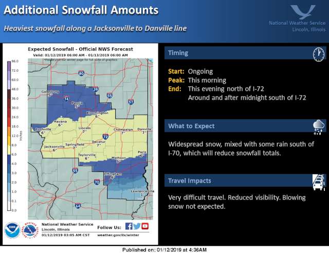
While the area remains under a Winter Weather Advisory through 6pm Saturday evening, the heaviest snowfall, according to the National Weather Service, will fall north of the Effingham area.
As the graphic below indicates, additional snowfall on Saturday is forecast to be heaviest from a Taylorville to Mattoon to Paris line, where an additional 6-7 inches is expected. The Effingham area is expected to see another 4 inches of snow on Saturday, with locally higher amounts possible.
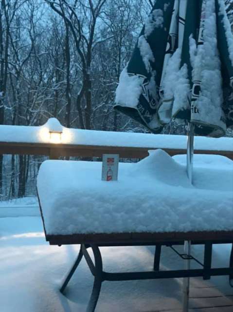
Areas around Effingham have already seen significant snowfall amounts, like the measurement below near Beecher City of 7.5 inches. If you'd like to share totals from your location, we're looking for area measurements here on our Facebook page.
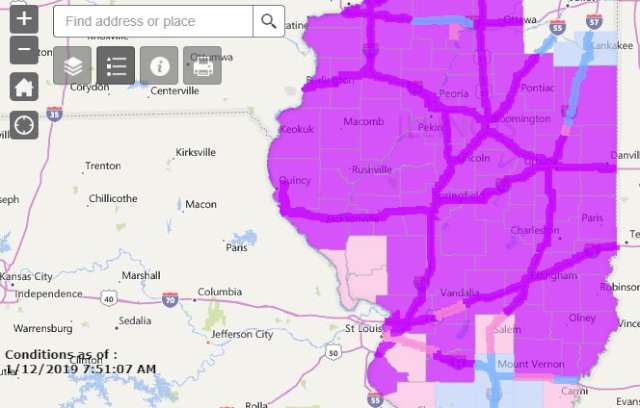
Road conditions continue to be an issue for almost all of Illinois, with IDOT reporting Interstates in our area as covered with snow or ice. Local roads are in similar shape as of Saturday morning.


Community Calendar
- February 11, 2025
Ballard Nature Center Events - February 11, 2025
Catholic Charities Tax Prep Assistance - February 11, 2025
ImpactLife Blood Drive at St. Anthony's Memorial Hospital - February 11, 2025
Library Events - February 11, 2025
Pere Marquette Bald Eagle Days